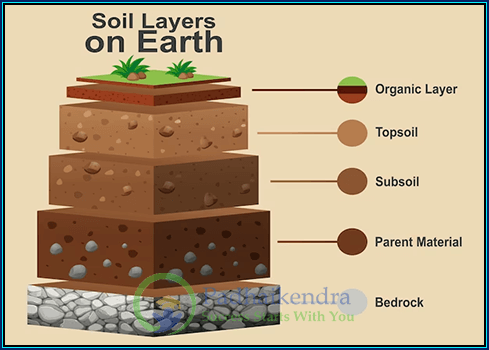
Maps are essential tools for understanding and navigating the world around us. They provide a visual representation of the geography and topography of different regions, and can be used to explore everything from cities and countries to continents and oceans.
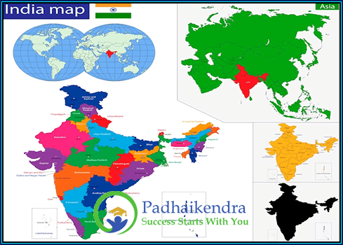
Maps of India:
India is a diverse country with a rich history and culture, and maps are a crucial tool for understanding its different regions, states, and cities. Maps of India can be divided into several categories, including political maps, physical maps, road maps, and thematic maps.
Political maps of India show the country’s boundaries and states, along with their capitals and major cities. These maps are useful for understanding the political and administrative structure of the country.
Physical maps of India show the topography of the country, including its mountains, rivers, and coastlines. These maps are essential for understanding the geography of the country and its impact on climate, vegetation, and agriculture.
Road maps of India provide detailed information about the country’s road networks, including highways, national and state highways, and major roads. These maps are useful for planning travel and transportation across the country.
Thematic maps of India focus on specific topics such as population, agriculture, and climate. These maps are useful for understanding the different aspects of the country in greater detail.